
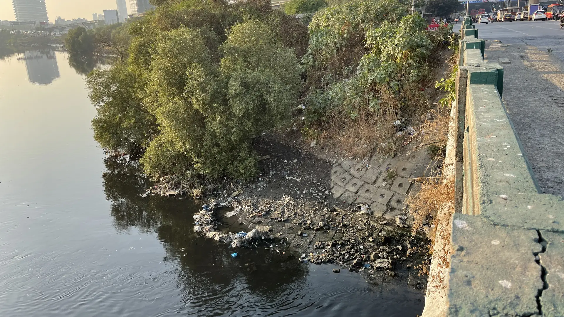
India’s mangroves cover less than a fifth of one per cent of the country, yet they hold tigers, fish nurseries, cyclone defences and some of the densest carbon stores on land. Their area has grown for four decades. Here are ten research-backed facts on mangroves in India, from where they grow to what is filling their roots with plastic, ending with what Earth5R’s river and coast work in Mumbai shows about keeping a mangrove healthy, not just green on a map.
Mangroves in India: the evidence at a glance
- Small area, long coastline
- Four decades of gain
- Tigers and 5,746 species
- Dense, open and thin
- Carbon in the mud
- The cyclone shield
- Fish nurseries and incomes
- Plastic in the roots
- A critically endangered south
- MISHTI and the restoration push
- What the numbers add up to
- Earth5R on the ground
- Case studies: the Mithi and the shore
- The five R’s for mangroves
- What companies and cities can do
- Questions
A mangrove is a salt-tolerant plant community of tropical and subtropical intertidal zones, adapted to waterlogged soil, high salinity and daily tides.[3] In India it grows along deltas, estuaries, creeks and island coasts, and in the middle of cities such as Mumbai. For how cyclones are already reshaping the Sundarbans, read our note on recording mangrove damage from cyclones in the Sundarbans.
01Fact
India has 4,991.68 sq km of mangroves, just 0.15% of its land, and two-thirds of it sits in West Bengal and Gujarat
The Forest Survey of India’s latest assessment, the India State of Forest Report 2023, puts the country’s mangrove cover at 4,991.68 square kilometres. That is 0.15% of India’s geographical area, an area smaller than many single districts.[1] The cover is spread across nine coastal states and three Union Territories, but it is far from even.
Where India’s mangroves are
Mangrove cover by State and Union Territory, 2023, sq km
Source: Forest Survey of India, India State of Forest Report 2023, as given in a Lok Sabha reply of 21 July 2025. Maharashtra, home to Mumbai’s mangroves, is highlighted.[1][2]
West Bengal, with the Indian Sundarbans, holds 42.45% of the national total. Gujarat holds 23.32% and the Andaman and Nicobar Islands 12.19%.[3] Andhra Pradesh, Maharashtra and Odisha follow, each with a few hundred square kilometres. Kerala, which once had extensive backwater mangroves, now records under 10 sq km.[2]
Mangroves are a thin, concentrated ecosystem. A handful of deltas and creeks carry most of the national total, so what happens in a few districts decides the national picture.
02Fact
India’s mangroves have grown for four decades, a net gain of 1.18 lakh hectares that only Australia beats
Global Mangrove Watch 4.1, released on World Mangrove Day in July 2026, estimates that India added nearly 1.18 lakh hectares of mangroves between 1985 and 2025. That is the second-highest net gain in the world, after Australia. Worldwide, the same satellite record shows a small net gain of 47,707 hectares over four decades, and warns that some gains in deltas reflect sediment changes upstream rather than conservation.[4]
Forty years of India’s mangrove maps
Mangrove cover assessed by the Forest Survey of India, sq km
Source: Forest Survey of India, India State of Forest Report 2023, Table 3.2 and Chapter 3. Mapping moved from 1:2,50,000 to a finer 1:50,000 scale from 2001, so the dip that year partly reflects method.[1]
India’s own maps tell the same story. Mangrove cover has risen by 363.68 sq km (7.86%) since 2013 and by 509.68 sq km (11.4%) since 2001.[3] Gujarat alone gained 253.06 sq km between 2001 and 2023 through large-scale planting, community participation and public-private partnerships.[3] The latest two-year step was flat: a net change of minus 7.43 sq km between 2021 and 2023, with Gujarat down 36.39 sq km while Andhra Pradesh added 13.01 sq km and Maharashtra 12.39 sq km.[1]
India is one of the few countries where mangrove area has grown for decades. The shared task now is to hold those gains through each two-year cycle and to make sure new area turns into a living forest.
03Fact
Indian mangroves hold 5,746 recorded species, and the Sundarbans tiger count has risen from 70 to 101 in twelve years
The Global Mangrove Alliance’s State of the World’s Mangroves 2024 notes that India’s mangroves have perhaps the highest recorded biodiversity of any country: 5,746 species across 21 phyla, of which 4,822 (84%) are animals. Indian mangroves alone account for 4.76% of the country’s recorded fauna.[5] The Sundarbans are home to globally threatened species including tigers, fishing cats, Gangetic dolphins, estuarine crocodiles, horseshoe crabs and river terrapins.[5]
Tigers of the mangrove delta
Tigers estimated in the Sundarbans landscape, All India Tiger Estimation
Source: National Tiger Conservation Authority and Wildlife Institute of India, landscape-wise estimates, 2010 to 2022.[8]
The Sundarbans tiger is the clearest sign that a mangrove forest can recover. The landscape’s estimate rose from 70 tigers in 2010 to 76 in 2014, 88 in 2018 and 101 in 2022.[8] West Bengal’s mangrove cover, including the Sundarbans, grew from 2,097 sq km in 2013 to 2,119.16 sq km in 2023, helped by eco-restoration under MISHTI and CAMPA and MGNREGS convergence.[9]
Biodiversity is the best test of mangrove health. A rising tiger count suggests the food web beneath it, from crabs and fish upwards, is holding together.
04Fact
Two in five hectares of India’s mangroves are open, thin-canopy forest, and only 29% is very dense
Area alone does not show health. The Forest Survey of India splits mangrove cover by canopy density. Of the 4,991.68 sq km mapped in 2023, very dense mangrove covers 1,463.97 sq km, moderately dense mangrove 1,500.84 sq km and open mangrove 2,026.87 sq km.[1]
How dense is India’s mangrove canopy?
Share of mangrove cover by canopy density class, 2023
Source: Forest Survey of India, India State of Forest Report 2023, Chapter 3. Density classes follow FSI definitions of tree canopy cover.[1]
Open mangrove, the largest class, can include young plantations, naturally sparse stands on salty flats and thinned or degraded forest. Maharashtra shows the pattern clearly: none of its 315.09 sq km is classed as very dense, 89.82 sq km is moderately dense and 225.27 sq km is open.[1] The IUCN’s assessment for south India records a similar warning sign: 3.2% of mangroves in that region are already degrading, with the potential to reach 9.5% within 50 years.[10]
Thickening an open stand is often worth more than adding a new strip. Monitoring should track canopy, survival and species mix, not only hectares planted.
05Fact
An average hectare of mangrove holds 394 tonnes of carbon, and four-fifths of it is in the mud, not the trees
Mangroves are among the most carbon-dense ecosystems on Earth. The latest global model compiled for the Global Mangrove Alliance finds an average of 394 tonnes of carbon per hectare in living biomass and the top metre of soil: 319 tonnes in soil, 54 tonnes above ground and 21 tonnes below ground. Some regions exceed 650 tonnes per hectare.[5]
Where mangrove carbon is stored
Average carbon stock per hectare of mangrove, tonnes of carbon, by pool (total 394 t)
Source: Global Mangrove Alliance, The State of the World’s Mangroves 2024, global soil carbon and biomass model. 319 t soil, 54 t above ground, 21 t below ground.[5]
The Ministry of Environment, citing WWF, notes that mangroves store 7.5 to 10 times more carbon per acre than tropical forests, that the world’s mangroves hold over 21 gigatonnes of carbon, 87% of it in the soil beneath their roots, and that their loss contributes about 10% of greenhouse gas emissions from deforestation.[3] The IUCN estimates that without significant change, climate change and sea-level rise could release 1.8 billion tonnes of stored mangrove carbon by 2050, 17% of the current total.[11]
Most mangrove carbon is in waterlogged soil that only stays put while the forest and its tides stay intact. Protecting an old mangrove keeps far more carbon in place than a new plantation can add for decades.
06Fact
In the 1999 Odisha super cyclone, villages behind wider mangroves suffered significantly fewer deaths
The strongest Indian evidence comes from the October 1999 super cyclone. Economists Saudamini Das and Jeffrey Vincent studied 409 inundated villages in Odisha that had mangroves between them and the coast in 1944. Villages with wider mangroves in 1999 experienced significantly fewer deaths than those with narrower or no mangroves, a result that held after controlling for distance to the coast, storm surge height and many other factors.[12]
A shield that had shrunk
Average width of mangroves between the study villages and the sea, Odisha
Source: Das and Vincent (2009), PNAS. Total mangrove area in the study zone fell from 30,766 ha to 17,900 ha over the same period.[12]
By 1999, the average mangrove belt in front of those villages had shrunk from 5.1 km in 1944 to 1.2 km. The authors found that the government’s early warning saved more lives than the mangroves did, and that keeping the remaining mangroves was economically justified on storm protection alone.[12] Global modelling by Delft University of Technology, summarised by the Global Mangrove Alliance, finds that mangroves typically lower flood depths by 15 to 20% in a one-in-100-year storm, and by over 70% in some places.[5]
Mangroves work best alongside early warnings and shelters, not instead of them. Each kilometre of forest between the sea and a village is part of its disaster plan.
07Fact
Mangroves support more than 700 billion young fish and shellfish a year, and Indian coastal villages are rebuilding incomes around them
A 2025 global study in Communications Earth and Environment modelled the density of 37 commercially important juvenile fish and invertebrates that depend heavily on mangroves. It estimates that the world’s mangroves support an annual abundance of over 700 billion of them, with some of the highest densities in South and Southeast Asia.[13] The IUCN adds that 14% of the world’s current fishing effort is supported by mangroves, and that 17 million days of fishing effort a year could be lost by 2050 without change.[11]
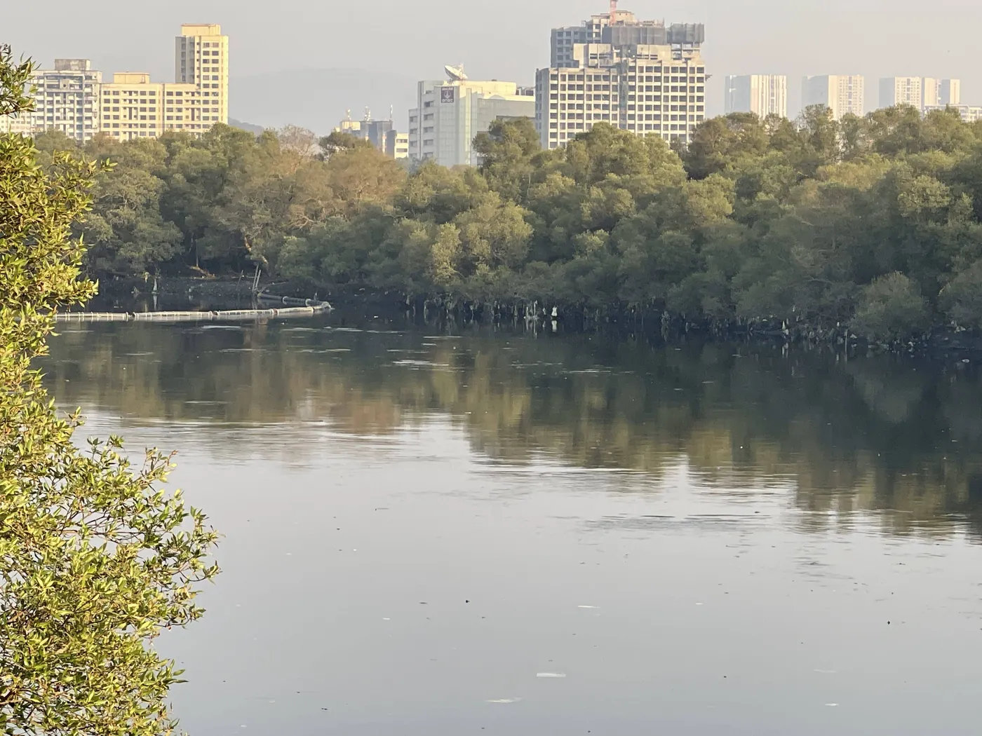
In Navghar, Maharashtra, a Mangrove Co-Management Committee formed in 2021 brought together villagers, the gram panchayat and women’s self-help groups under a Green Climate Fund and UNDP project with the Government of India. Women trained in sustainable crab farming now run groups such as Healthy Harvest and Wild Crab Aqua Farm on two acres of coastal land while guarding the mangroves from illegal cutting. “Earlier, women worked only seasonally. Now, we have employment throughout the year,” Vandana Patil told the Ministry.[3] Across Andhra Pradesh, Maharashtra and Odisha, the same project aims to restore and conserve 10,575 hectares of mangroves, and had restored 3,114.29 hectares by 2024.[3]
Mangroves pay their way through fish, crabs and steady work. Restoration that gives coastal families an income from a living forest is the restoration that gets protected.
08Fact
Maharashtra’s coastal mangroves hold 8.5 litter items per square metre, and 83% of it is plastic
Mangrove roots act like a net. Surveys by Ministry of Earth Sciences institutes, reported to Parliament in August 2025, found that coastal ecosystems such as mangroves, estuaries and coral reefs are the most sensitive to accumulating marine litter and microplastic. Along the Maharashtra coast, mangroves held an average of 8.5 litter items per square metre, ranging from 1.4 to 26.9, and plastic made up 83.02% of it. Goa’s coastal mangroves held 5.14 items per square metre, 66% of it plastic, traced mainly to mismanaged land-based waste and public littering.[6]
Litter trapped in mangroves
Average marine litter density, items per square metre
Source: Ministry of Earth Sciences, reply in the Lok Sabha, Press Information Bureau, 6 August 2025.[6]
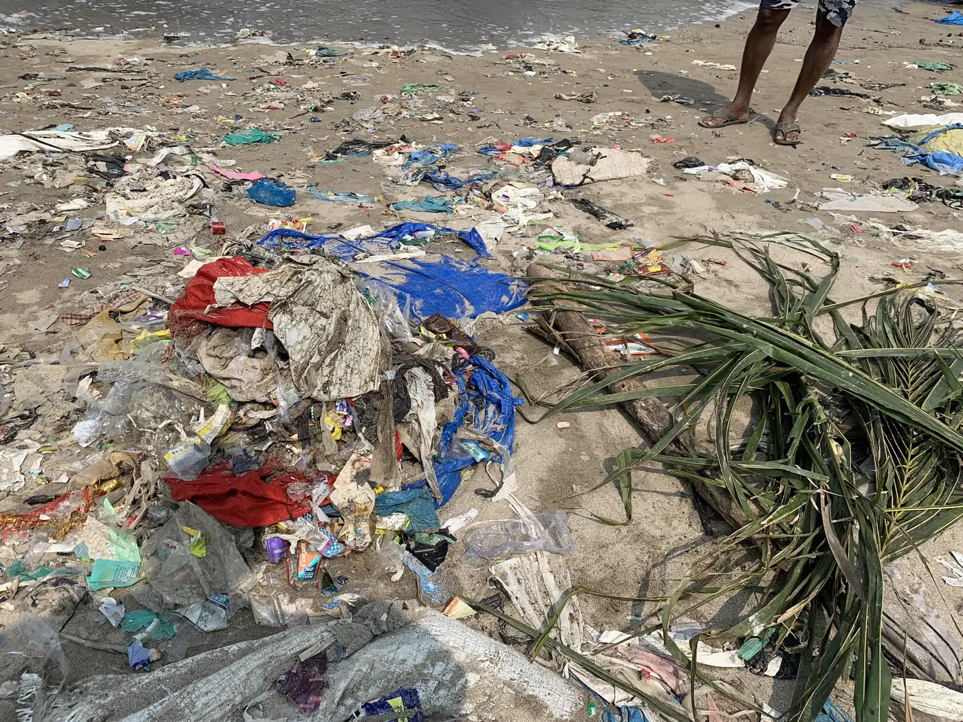
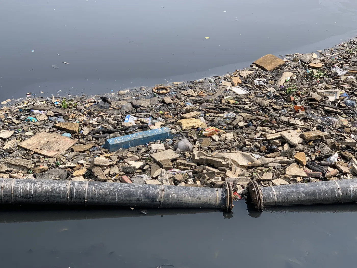
The litter does not stay whole. Plastic caught in the roots breaks down into microplastics in the sediment, as our brief on microplastics in India describes for the Bhitarkanika mangroves in Odisha. In the Mumbai Metropolitan Region, one programme run by United Way Mumbai engaged 70 workers to clean mangrove areas and has cleared 346 tonnes of non-biodegradable waste since 2022, sending it for recycling and co-processing.[5]
Mangroves catch what a city fails to hold on to. Every bag segregated at home or stopped in a drain is one less wrapped around a mangrove root at the creek mouth.
09Fact
Half the world’s mangrove ecosystems are at risk of collapse, and the south India and Sri Lanka province is Critically Endangered
In May 2024 the IUCN published the first global Red List of Ecosystems assessment for mangroves. Of the 36 mangrove provinces assessed, 50% are at risk of collapse and 19.6% at high risk. Climate change threatens a third of them.[11] The mangroves of south India, Sri Lanka and the Maldives, covering the marine ecoregions of western and south India, were assessed as Critically Endangered, the highest category short of collapse.[10]
The assessment names the main threats in the region: reduced freshwater flow and the hypersaline conditions that follow, conversion for aquaculture and tourism, changes in sediment and poor tidal exchange, and climate change, especially sea-level rise and storm surges. Under a high sea-level rise scenario, 82.7% of the province’s mangroves would be submerged by 2060.[10] The Sundarbans face the same pressure from the east: Cyclone Amphan caused the most mangrove damage of three recent cyclones, with the highest losses along shorelines that had been eroding for 35 years.[14]
There is a recovery story too. A study by ICAR-Central Marine Fisheries Research Institute, presented in Kochi on 6 November 2026, compared satellite images from 2017 and 2026 and found an overall rise in Kerala’s mangrove cover, even though the state lost nearly 90% of its mangroves over the past five decades.[15]
Risk and recovery sit side by side. The places most at risk are the ones where freshwater, sediment and tides have been cut off, so restoring that water is as important as planting.
10Fact
MISHTI aims to restore 540 sq km of mangroves, and 22,560 hectares were taken up in its first two years
The Mangrove Initiative for Shoreline Habitats and Tangible Incomes (MISHTI), announced in the Union Budget 2023-24 and launched on 5 June 2023, aims at restoration and afforestation across 540 sq km in nine coastal states and four Union Territories.[3] It works through convergence with State and National CAMPA, MGNREGS and state plans. By August 2025, 22,560.34 hectares had been taken up across 13 States and UTs for plantation and restoration of degraded mangroves.[7]
MISHTI’s first two years
Area taken up for mangrove plantation and restoration, 2023-24 and 2024-25, hectares
Source: Ministry of Environment, Forest and Climate Change, Rajya Sabha reply, 21 August 2025. Kerala (8.88 ha) and Puducherry (6 ha) are not shown.[7]
Gujarat accounts for 19,220 hectares, about 85% of the total, followed by Tamil Nadu, Andhra Pradesh and Odisha. MISHTI also funds livelihood diversification, awareness, research and mangrove ecotourism through self-help groups, with ₹12.874 crore proposed for ecotourism, and gives local communities a central role in nursery raising, planting, seed collection, channel excavation and monitoring.[7] It sits on top of firm legal protection: the Coastal Regulation Zone Notification, 2019 treats mangroves as Ecologically Sensitive Areas, sets a 50-metre buffer where mangrove cover exceeds 1,000 square metres, and requires three mangroves to be replanted for every one lost to development.[2] The National Coastal Mission also supports conservation at 38 mangrove sites.[3]
India has the framework, the money channels and the momentum. Spreading restoration to every coastal state and following each site to a dense, self-sustaining forest is the shared task for companies, communities and governments.
What the numbers add up to: India is winning on area, and the next contest is quality, water and waste
Read together, the ten facts point one way. India has done what few countries have: it has grown its mangrove area for four decades, with strong law behind it and a national restoration mission on top.[4][2][7] The pressures now are quieter. They are thin canopies, cut-off freshwater and sediment, sea-level rise and, in cities, a daily load of plastic that washes into the roots.[1][10][6]
Mangroves in Maharashtra, district by district
Mangrove cover, 2023, sq km
Source: Forest Survey of India, India State of Forest Report 2023, Table 3.4. Mumbai city (2.82 sq km) and Mumbai Suburban (56.80 sq km) are combined.[1]
Mumbai shows both sides. The city and its suburban district still hold about 59.6 sq km of mangroves, more than Thane, Palghar or Ratnagiri, inside one of India’s densest cities.[1] Maharashtra added 12.39 sq km between 2021 and 2023, but all of its mangroves are moderately dense or open.[1] The same creeks that hold these forests receive the outflow of rivers such as the Mithi, which runs 17.8 km through the city to Mahim Creek and the Arabian Sea.[16]
Planting builds area. Keeping freshwater flowing and plastic out of creeks builds quality. The second job happens upstream, in catchments, drains and homes, and that is where companies and citizens can do the most.
Earth5R’s work reaches mangroves from upstream: 11,100 tonnes taken out of the Mithi before it could reach Mahim Creek
Earth5R is a Mumbai-based environmental organisation, recognised under UNESCO Green Citizens, that has run climate and sustainability programmes across India since 2014.[17] Its mangrove work is mostly indirect, and deliberately so. Mumbai’s mangroves sit in creeks and estuaries at the end of the city’s rivers and drains, and the plastic in their roots arrives from the catchment. Our brief on beach cleanups in India put it simply: every tonne stopped in a catchment is a tonne no one has to pull off a mangrove root.[17]
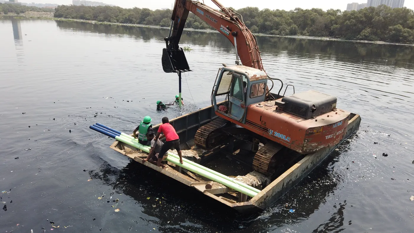
The Mithi runs 17.8 km from the overflow of Vihar and Powai lakes to Mahim Creek, carrying industrial effluent, household waste, plastic and organic debris downstream “toward the creek and the sea”.[16] From October 2020, Earth5R placed a solar-powered plastic recovery unit, developed with RiverRecycle, in the channel to intercept floating debris and move it to the bank for segregation, washing and shredding. High-value plastic went to recycling, and low-value plastic to pyrolysis into industrial-grade oil.[16]
What came out of the Mithi
Waste removed by the Earth5R Mithi programme, October 2020 to November 2024, tonnes
Source: Earth5R Mithi River case study, written by Saurabh Gupta. 11,100 t in total. Programme-reported.[16]
These are programme-reported figures from Earth5R’s Mithi case study and cover October 2020 to November 2024 only. They have not been independently audited for this article. The case study estimates about 6,660 tonnes of CO₂e avoided by recycling the recovered plastic, at 1.5 t CO₂e per tonne. This is an estimate, not a carbon credit, and no credits were issued or claimed.[16]
The people who did the work
The Mithi’s catchment programme was built on people, not machines. Households were paid for the segregated plastic they handed over, which, in the case study’s words, “turned waste from something to dispose of into something with a price”. Women in the catchment were trained to upcycle waste into paper bags, lamps and handicrafts, and families learned to compost organic waste for growing herbs and medicinal plants at home.[16] Earth5R’s wetland work in Mumbai and Pune follows the same recurring model, in which slum residents, students, housing societies and corporate volunteers adopt a stretch of river and keep coming back to it, as Mridu Mishra describes in Earth5R’s participatory wetland conservation strategy.[18]
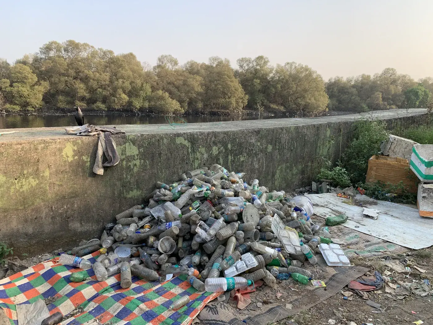
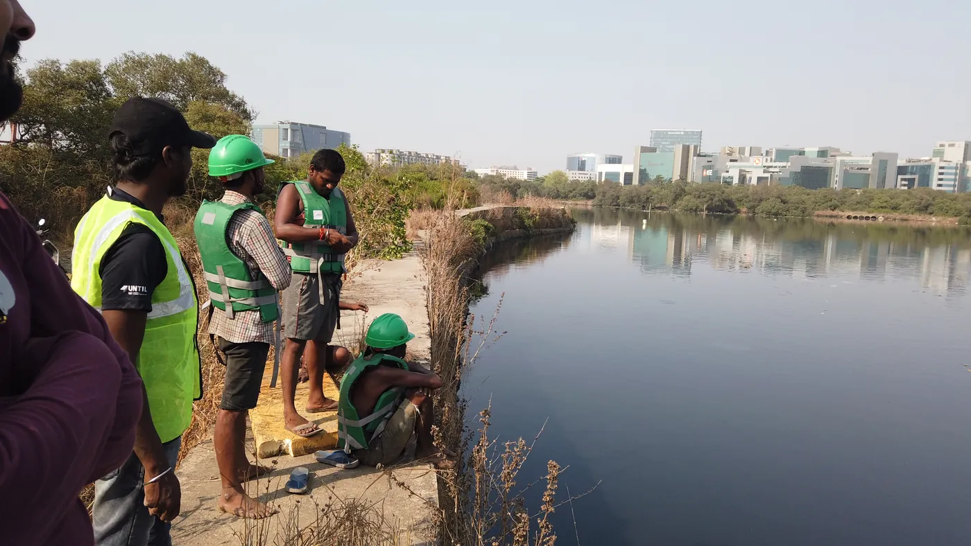
For an urban mangrove, the most useful work often happens kilometres away. A recovery unit, a paid price for segregated plastic and a trained catchment keep the load off the creek in a way no single shoreline cleanup can.
Case studies: a river programme that worked on the catchment, and a shoreline cleanup that started with the coast’s mangroves
The Mithi: catchment first, river second
Earth5R delivered the Mithi project with United Nations Technology Innovation Labs, Huhtamäki, RiverRecycle and the Municipal Corporation of Greater Mumbai, supported by €0.6 million in funding.[16] The operating rate averaged about 10 tonnes of waste a day, around 4 tonnes of it plastic.[16] Earth5R describes the programme as applying its five R’s, Respect, Reduce, Reuse, Recycle, Restore, “through operational mechanisms rather than awareness campaigns alone”.[19] Read the full record in the Mithi River case study and the CSR model in our river cleanup CSR project page.
Juhu, International Coastal Cleanup Day
On International Coastal Cleanup Day, 17 September, about 37 employees of Hexaware Technologies joined the Earth5R team to clean Juhu beach after the Ganesh immersions. The Earth5R volunteers included founder and CEO Saurabh Gupta, product designer Sunny Singh, Akshita Shah and Ramesh Zaru. Earth5R’s report of the day opened not with the beach but with the state of India’s coasts, including the loss and partial recovery of its mangroves.[20] The lesson Earth5R drew from a decade of such cleanups is that segregating on the spot turns litter into material a recycler can use, and that a cleanup only lasts if someone downstream earns from the waste.[17]
Our urban lake restoration brief and climate change in India listicle show the same pattern for lakes and for coastal climate risk: restoration lasts when local people have a role and a reason to stay.
The two cases meet at the creek mouth. Upstream, the Mithi programme reduces what arrives. On the shore, cleanups and volunteers deal with what still gets through, and both are needed for a mangrove to stay healthy.
The five R’s for mangroves start with Respect, because a mangrove is a coastline’s defence, not spare land
In the words of founder Saurabh Gupta, “The 5R in Earth5R comes from a sequence we have taught since 2014: Respect, Reduce, Reuse, Recycle, Restore. The order matters. Respect comes first, respect for nature, for communities and for the limits of growth. A programme that starts at Recycle has skipped the three most important steps.”[21] Mangroves show why the order matters.
| R | What it means for mangroves | Evidence and Earth5R work |
|---|---|---|
| Respect | Respect the limits of the intertidal zone and the people who live from it. Treat mangroves as protected infrastructure, not land waiting for use. | CRZ 2019 classes mangroves as Ecologically Sensitive Areas with a 50-metre buffer.[2] Villages behind wider mangroves suffered fewer cyclone deaths in 1999.[12] |
| Reduce | Cut the plastic and waste that reaches creeks at its source, in homes, markets and drains. | 83.02% of litter in Maharashtra’s mangroves is plastic.[6] The Mithi programme trained 10,000 families and 500 businesses in segregation.[16] |
| Reuse | Extend the life of materials before they can wash downstream, and give households income from them. | Mithi catchment households upcycled waste into paper bags, lamps and handicrafts.[16] |
| Recycle | Recover what is collected through proper channels and return value to the people who collect it. | The Mithi programme recovered 4,440 tonnes of plastic and paid residents for segregated plastic.[16] |
| Restore | Rebuild mangrove forests and the freshwater, sediment and tidal flows they need, and the public data that builds trust. | MISHTI has taken up 22,560 hectares for restoration.[7] Satellite monitoring tracks cyclone damage in the Sundarbans.[14] |
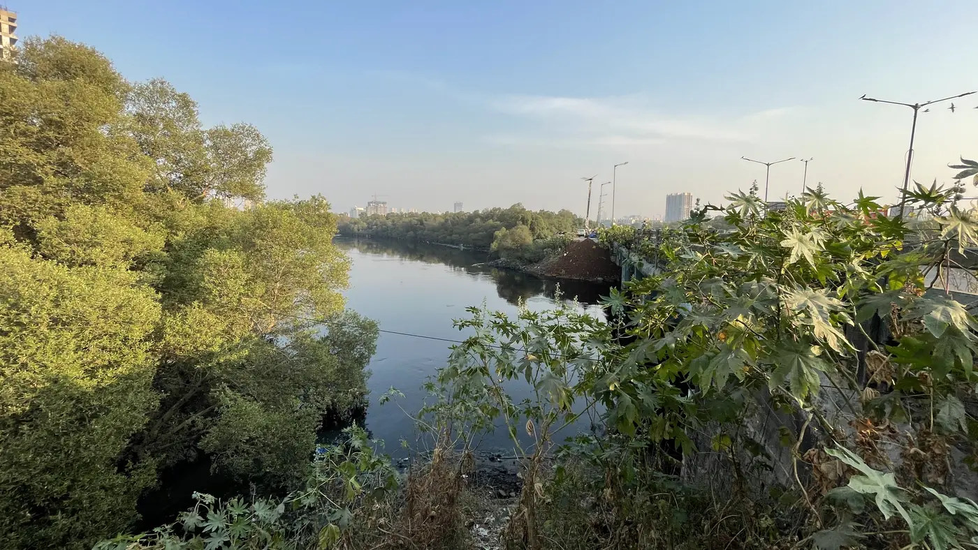
Planting comes at the end of the sequence, not the start. Respect protects what exists, Reduce, Reuse and Recycle keep plastic out of the roots, and Restore rebuilds the forest and the water that feeds it.
What companies, housing societies and cities can do for mangroves in India
Practical steps, each linked to the evidence above.
- Fund the catchment, not just the planting. Plastic in mangroves comes from land-based waste.[6] Segregation training and paid collection upstream, as on the Mithi, reduce the load that reaches the creek.[16]
- Back MISHTI-style restoration with survival tracking. Partner with forest departments and coastal communities, and report canopy density and survival over years, not saplings planted in a week.[7][1]
- Use CSR rules that already fit. Schedule VII of the Companies Act, 2013 covers ecological balance, protection of flora and fauna and conservation of natural resources.[22]
- Disclose properly in BRSR. SEBI’s BRSR asks listed companies to report operations in or around ecologically sensitive areas, including coastal regulation zones and wetlands, and their impact on biodiversity there.[23]
- Put livelihoods at the centre. Crab farming and ecotourism through self-help groups, as in Navghar and under MISHTI, give coastal families a reason to protect the forest.[3][7]
- Treat blue carbon claims with care. Mangrove soils hold most of the carbon, so protection of old forest usually matters more than new planting, and any carbon figure should say how it was measured.[5]
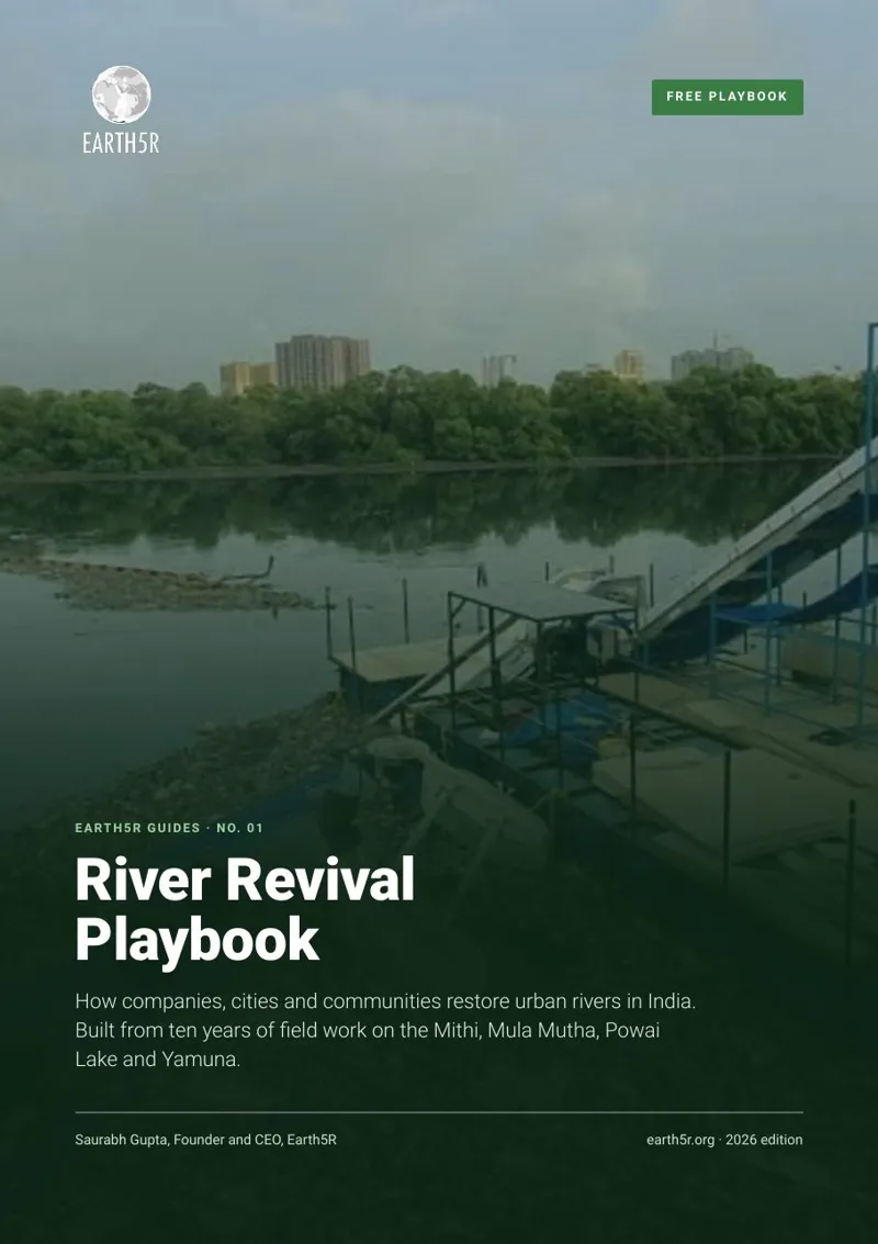
Free guide · Earth5R Guides No. 01
How companies, cities and communities restore urban rivers, with the Mithi River case, a programme charter and a budget workbook.
Our BRSR Core guide explains what listed companies disclose, and Earth5R’s ESG and BRSR reporting service helps teams build the evidence trail. Employees and residents can join river and shoreline drives through the Earth5R app, and our tree plantation brief sets out why survival, not saplings, is the measure that counts.
Talk to Earth5R about a coastal or river programmeSee Earth5R’s CSR and ESG projects
Frequently asked questions about mangroves in India
- How much mangrove cover does India have?
- India had 4,991.68 sq km of mangrove cover in 2023, about 0.15% of its geographical area, according to the Forest Survey of India. West Bengal holds 42.45% of it, Gujarat 23.32% and the Andaman and Nicobar Islands 12.19%.[1][3]
- Is India’s mangrove cover increasing?
- Yes, over the long term. Mangrove cover rose by 509.68 sq km between 2001 and 2023, and Global Mangrove Watch estimates a net gain of about 1.18 lakh hectares between 1985 and 2025, the second highest in the world. Between 2021 and 2023 the net change was a small decrease of 7.43 sq km.[3][4][1]
- What is the MISHTI scheme?
- The Mangrove Initiative for Shoreline Habitats and Tangible Incomes, launched on 5 June 2023, aims to restore and plant mangroves across 540 sq km in coastal states and Union Territories. By August 2025, 22,560.34 hectares had been taken up across 13 States and UTs.[3][7]
- How much carbon do mangroves store?
- On average, mangroves hold about 394 tonnes of carbon per hectare in living biomass and the top metre of soil, of which 319 tonnes is in the soil, according to the Global Mangrove Alliance.[5]
- How do mangroves protect against cyclones?
- Mangroves slow waves and storm surges. In the 1999 Odisha super cyclone, villages with wider mangroves between them and the sea had significantly fewer deaths, and global modelling finds mangroves typically cut flood depths by 15 to 20% in a one-in-100-year storm.[12][5]
- How can companies support mangrove conservation in India?
- Companies can fund restoration with long-term survival monitoring, support waste segregation and collection in the catchments that drain into mangrove creeks, back coastal livelihoods, and disclose operations near ecologically sensitive areas in BRSR. Mangrove conservation is an eligible CSR activity under Schedule VII.[23][22]
Related reading on Earth5R
References
- Forest Survey of India (2024). India State of Forest Report 2023, Volume 1, Chapter 3: Mangrove Cover, including Table 3.2 (mangrove cover 1987 to 2021) and Table 3.4 (district-wise mangrove cover 2023). Ministry of Environment, Forest and Climate Change, Dehradun. fsi.nic.in
- Ministry of Environment, Forest and Climate Change (2025). Mangrove cover in the country. Written reply in the Lok Sabha, Press Information Bureau, 21 July 2025, with State/UT mangrove cover from ISFR 2019 and ISFR 2023. pib.gov.in
- Ministry of Environment, Forest and Climate Change (2025). Where the Land Meets the Sea: Mangroves as Guardians of Life and Livelihoods. Press Information Bureau feature, 29 March 2025. static.pib.gov.in
- Business Today Desk (2026). India adds 1.18 lakh hectares of mangroves in 40 years, second-highest gain globally: report. Business Today, 27 July 2026, reporting Global Mangrove Watch 4.1. businesstoday.in
- Leal, M. and Spalding, M. D. (editors) (2024). The State of the World’s Mangroves 2024. Global Mangrove Alliance. mangroveactionproject.org
- Ministry of Earth Sciences (2025). Parliament question: survey to assess microplastic and marine debris. Written reply in the Lok Sabha, Press Information Bureau, 6 August 2025. pib.gov.in
- Ministry of Environment, Forest and Climate Change (2025). Parliamentary question: MISHTI scheme. Written reply in the Rajya Sabha (Unstarred Question 3265), Press Information Bureau, 21 August 2025. pib.gov.in
- National Tiger Conservation Authority and Wildlife Institute of India (2024). Details of tiger estimation by landscape for 2006, 2010, 2014, 2018 and 2022, as per All India Tiger Estimation reports. Annexure to a reply in Parliament, Press Information Bureau, November 2024. static.pib.gov.in
- Ministry of Environment, Forest and Climate Change (2025). Mangrove cover in West Bengal and the Sundarbans. Written reply in Parliament, Press Information Bureau, 11 August 2025. pib.gov.in
- Selvam, V., Ramasubramanian, R., Kathiresan, K., Manoj Prasanna, M. G., Kodikara, K. A. S., Amarasinghe, M. and Suarez, E. (2024). IUCN Red List of Ecosystems: Mangroves of South India and Sri Lanka, and Maldives. EcoEvoRxiv preprint, version 3, updated 2 March 2025. doi.org/10.32942/x21k7f
- International Union for Conservation of Nature (2024). More than half of all mangrove ecosystems at risk of collapse by 2050, first global assessment finds. Press release, Gland, 22 May 2024. iucn.org
- Das, S. and Vincent, J. R. (2009). Mangroves protected villages and reduced death toll during Indian super cyclone. Proceedings of the National Academy of Sciences 106(18): 7357 to 7360. doi.org/10.1073/pnas.0810440106
- zu Ermgassen, P. S. E., Worthington, T. A., Gair, J. R. et al. (2025). Mangroves support an estimated annual abundance of over 700 billion juvenile fish and invertebrates. Communications Earth and Environment 6, 17 April 2025. nature.com
- Earth5R Team (2024). Recording mangrove damage from cyclones in the Sundarbans. EarthJournal, Earth5R, 20 March 2024. earth5r.org
- The Hindu Bureau (2026). Keralam’s mangrove cover expanded in past decade despite prior decline, finds study. The Hindu, Kochi, 6 November 2026, reporting an ICAR-Central Marine Fisheries Research Institute satellite study. thehindu.com
- Gupta, S. (2025). Mithi River Plastic Waste Cleanup: What 11,100 Tonnes Actually Took. Case study, Earth5R, figures for October 2020 to November 2024. Programme-reported. earth5r.org
- Earth5R (2026). Beach Cleanup in India: what a decade of shoreline data and Earth5R field work show. EarthJournal, 23 October 2026. earth5r.org
- Mishra, M. Earth5R’s participatory wetland conservation strategy in action. EarthJournal, Earth5R. earth5r.org
- Earth5R (2026). River Cleanup CSR Project in India: the Mithi River programme. earth5r.org
- Shah, A. (reporter). Juhu Beach Cleanup: A Collaborative Effort by Earth5R and Hexaware. EarthJournal, Earth5R. earth5r.org
- Gupta, S. (2026). AI and Sustainability: Planetary Limits. EarthJournal, Earth5R. Section on the Earth5R method, Respect, Reduce, Reuse, Recycle, Restore. earth5r.org
- Companies Act, 2013, Schedule VII: Activities which may be included by companies in their Corporate Social Responsibility policies, item (iv). ca2013.com
- Securities and Exchange Board of India (2021). Business Responsibility and Sustainability Report, Annexure I format, Principle 6, Essential Indicator 10 and Leadership Indicator 5. May 2021. sebi.gov.in
How to cite this article
Earth5R (2026). Mangroves in India: 10 Facts on Cover, Blue Carbon, Cyclones, Plastic and What Restores Them. EarthJournal, Earth5R, 18 November 2026. https://earth5r.org/mangroves-india/
Figures are taken from the sources cited and were current on 18 November 2026. Forest Survey of India maps and Global Mangrove Watch satellite estimates use different methods, scales and years and are not directly comparable. One lakh hectares is 1,000 sq km. Earth5R figures are programme-reported and link to the case studies they come from.